Hi all,
I’m not sure where this question fits in. I am trying to find a model to capture a very specific scenario.
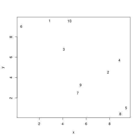
I have data which I assume are spatially correlated. Something like in the following plot:
Assuming I’m predicting a gaussian outcome, I would normally do something like:
brm(y ~ 1 + gp(x, y) ...)
To account for the spatial correlation. However, I know that there is a highway (in this case a river) which is connecting 6, 3, 2, and 4.
(1) In the simplest scenario, I would like to be able to account for a higher rate of contact (is that the right word?) between the observations on the highway than between the rest of observations.
In a way, the model should know that the distance between 6, 3, 2, and 4 is reduced.
(2) In the more complex scenario, I would also like to specify that the highway acts as a barrier, so there is a penalty for crossing it. In this toy example, the distance between 10 and 9 should be larger than it would otherwise be were it not for the highway.
One idea I had was to group the observations into three groups c(1, 10), c(6, 3, 2, 4) and c(7, 9, 5, 8) and then do
brm(y ~ 1 + gp(x, y, by = group) ...)
But if I understand it correctly, this assumes that there is no contact across groups. Additionally, this means I have to manually decide which observations belong to which group. But this isn’t always clear.
Is there any way of doing either (1) or (2) in either brms or directly in Stan?
Thanks!